

|
|
|
History | Books | Activities | Additional Information
| Description
The California Trail system (more than 5,500 miles) was developed over a period of years, and numerous cutoffs and alternate routes were tried to see which was the "best" in terms of terrain, length and sufficient water and grass for livestock. The general route began at various jumping off points along the Missouri River and stretched to various points in California, Oregon, and the Sierra Nevada. The specific route that emigrants and forty-niners used depended on their starting point in Missouri, their final destination in California, the condition of their wagons and livestock, and yearly changes in water and forage along the different routes. The trail passes through the states of Missouri, Kansas, Nebraska, Colorado, Wyoming, Utah, Nevada, Oregon, and California.
|
| History
Established August 3, 1992, the general route has various "jumping-off" points along the Missouri River, including Independence and St. Joseph, Missouri, Council Bluffs Iowa and Nebraska City, Nebraska. It stretched to various points in California, Oregon and the Sierra Nevada Mountains. The specific route that emigrants, or forty-niners used, depended on their starting point in Missouri, their final destination in California, the condition of their livestock and wagons and yearly changes in water and forage along the different routes. The trail passes through the states of Missouri, Kansas, Nebraska, Colorado, Wyoming, Utah, Nevada, Oregon and California. The California Trail system was developed over a period of years, and numerous cutoffs and alternate routes were tried to see which was the "best" in terms of terrain, length and sufficient water and grass for livestock. The total California National Historic Trail system includes approximately 5,665 miles. Of this, approximately 1,100 miles of trail still exist on the ground as trail ruts, traces and other obvious remnants. About 2,171 miles of this system cross public lands, where most of the physical evidence that still exists today is located. An estimated 320 historic sites along the trail system will eventually be available for public use and interpretation. It carried over 200,000 gold-seekers and farmers to the gold fields and rich farmlands of California during the 1840's and 1859's, the greatest mass migration in American history. Today, more than 1,000 miles of trail ruts and traces can still be seen in the vast undeveloped lands between Casper Wyoming and the West Coast, reminders of the sacrifices, struggles, and triumphs of early American travelers and settlers. Central cutoffs and alternate routes include: Sublette Cutoff - 1844 Hastings Cutoff - 1846 Salt Lake Cutoff - 1848 Hudspeth Cutoff - 1849 Childs Cutoff - 1850 Kinney Cutoff - 1850 Seminoe Cutoff - 1850 Slate Creek Cutoff - 1850 Baker-Davis Road - 1852 Dempsey-Hockadsy Cutoff - 1856 Lander Road - 1858 Julesburg Cutoff - 1859 Western routes include: Truckee Route - 1844 Applegate Trail - 1846 Carson Route - 1848 Lassen Route - 1848 Beckwourth Trail - 1851 Nobles Road - 1852 Sonora Road - 1852
The National Park Service is currently developing a Comprehensive Management and Use Plan for the California Trail. When completed, it will describe the official auto tour route, list historic sites and cross country segments and make recommendations for resource protection, trail management and marking. Many of the sites and segments are on public land and are open to visitors. Others are located on private lands-please obtain the landowners permission before entry. Information on trail routes and history is available from the National Park Service Long Distance Trails Office. Information on accessibility and travel conditions along the cross-country segments is best obtained from local offices of the Bureau of Land Management or the National Forest Service. Agency addresses are listed below.
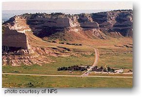
Federal Government Homestead National Monument can suggest places to visit along the trail corridor or auto tour route in Nebraska. Write Homestead National Monument, Route 3, Box 47, Beatrice, Nebraska 66310, or call (402) 223-3514. Scotts Bluff National Monument is a prominent natural landmark for emigrants on the Oregon and California Trails. It has a visitor center, museum and bookstore. You can also drive or hike to the summit and visit trail ruts. Write Scotts Bluff National Monument, P.O. Box 27, Gering, Nebraska 69341-0027, or call (308) 436-4340. The City of Rocks National Reserve is approximately ten miles of California Trail Corridor within the reserve. It can provide information on the California Trail in southern Idaho. Write City of Rocks National Reserve, Idaho Department of Parks and Recreation, P.O. Box 169, Almo, ID 83312, or call (208) 824- 5519. The Nobles Emigrant Trail branch of the California Trail pass through Lassen Volcanic National Park, and the Lassen Trail is nearby. It has a visitor center, exhibits, hiking and a "Pioneers" interpretive program. Write Lassen Volcanic National Park, P.O. Box 100, Mineral, CA 96063-0100, or call (916) 595- 4444. The primary information office for the Oregon, California, Mormon and Pony Express National Historic Trails is the Bureau of Land Management's (BLM) Historic Trails Office. It can provide a wealth of information on trail routes, historic sites, accessibility and trail conditions. Write Bureau of Land Management, Historic Trails Office, 2987 Prospector Drive, Casper, WY 82601, or call (307) 261-7600. The Deep Creek Resource Area Office manages The Hudspeth's Cutoff (an alternate route from the Oregon Trail to the head of the California Trail). The publication "Emigrant Trails of Southern Idaho" is available from them. Write Bureau of Land Management, Deep Creek Resource Area Office, 138 South Main, Malad City, ID 83252, or call (208) 766-4766. The Eastern Idaho Visitor Information Center can provide Idaho state maps, and various maps (National Forest service, BLM Surface Management and USGS 7.5 Minute Topos) of Idaho and western Wyoming, as well as books on Idaho and surrounding attractions. Write Bureau of Land Management, Eastern Idaho Visitor Information Center, 505 Lindsay Boulevard, P.O. Box 50498, Idaho Falls, ID 83405, or call (208) 523-1012. Pocatello Resource Area is where several historic trail segments crossed. It can provide several pamphlets on trails in the area and the publication "Emigrant Trails of Southern Idaho." Write Pocatello Resource Area, 1111 N. 8th Ave., Pocatello, ID 83201, or call (208) 236-6860. The Nevada State Office can provide general statewide information on the Pony Express and California Trails. More specific information can be obtained from the districts listed below, which provide on-the-ground management of the trails. Write Bureau of Land Management, Nevada State Office, P.O. Box 12000. 850 Harvard Waymore, (702) 785-6628, or call Reno, NV 89520. BLM-Winnemucca District manages the Applegate-Lassen segment of the California Trail in Nevada. It can provide information on accessibility and trail conditions across their management area. Write BLM-Winnemucca District, 705 East 4th Street, Winnemucca, NV 89445, or call (702) 623-1500. The Surprise Resource Area manages a section of the Applegate/Lassen route of the California Trail in California. It can provide information on trail conditions and accessibility through High Rock Canyon and Surprise Valley. Write BLM-Surprise Resource Area, P.O. Box 460, 602 Cressler Street, Cedarville, CA 96104-0460, or call (916) 279-2171. National Forest Service Plumas National Forest can provide a brochure on the Beckwourth Trail route (a branch of the California Trail System) and information on accessibility and trail conditions. Write Plumas National Forest, P.O. Box 11500, 1159 Lawrence Street, Quincy, CA 95971, or call (916) 283-2050. Tahoe National Forest can provide a detailed map of the California Trail across the Tahoe National Forest and information on trail conditions and accessibility. Write Forest Archaeologist, Tahoe National Forest, P.O. Box 6003, Nevada City, CA 95959, or call (916) 265-4531. State Historic sites and Organizations Fort Kearny State Historic Park was the first military post along the Oregon Trail. It offers a museum, outdoor exhibits, book store. Write Fort Kearny State Historic Park, Route 4, Kearney, NE 68847, or call (308) 234-9513. Ash Hollow State Historic Park has prominent Oregon Trail ruts, Windlass Hill, a museum, and outdoor exhibits. Write Ash Hollow State Historic Park, P.O. Box A, Lewellen, NE 69147, or call (308) 778-5651. Fort Sedgewick Depot Museum was the site of a pony express station. It has exhibits, a museum and information on the Pony Express and South Platte River Trail. Write Fort Sedgewick Depot Museum, P.O. Box 69, Julesburg, CO 80737, or call (303) 474- 2264. Fort Bridger State Historic Site has a restored military and fur trade post, museum, and outdoor exhibits. It can provide information on Oregon, California, Pony Express and Mormon Trails in southwest Wyoming. Call Fort Bridger State Historic Site, Box 35, Fort Bridger, WY 82933, or call (307) 782-3842. Utah Division of Parks and Recreation has information on the Hastings Cutoff Route in Temple Utah, especially the hiking segment between Mormon Flat and Big Mountain. Write Utah Division of Parks and Recreation, 1636 W. North Temple, Salt Lake City, UT 84116, or call (801) 538-7344. The Oregon Trail Coordinating Council can provide detailed information on the Applegate Trail in Oregon. Write Oregon Trail Coordinating Council, 222 NW Davis, Suite 309, Portland, OR 97205, or call (503) 228-7245. Marshall Gold Discovery can provide information on Coloma; gold discovery site on the South Fork of the American River. Write Marshall Gold Discovery, State Historic Park, P.O. Box 265, Coloma, CA 95613.
|
|
For Additional Information Contact:
California
National Historic Trail
For more information visit the National Park Service website
|
 The
California Trail carried over 200,000 gold-seekers and farmers to the
gold fields and rich farmlands of California during the 1840's and 1850's,
the greatest mass migration in American history. Today, more than 1,000
miles of trail ruts and traces can still be seen in the vast undeveloped
lands between Casper Wyoming and the West Coast, reminders of the sacrifices,
struggles, and triumphs of early American travelers and settlers. More
than 240 historic sites along the trail will eventually be available
for public use and interpretation.
The
California Trail carried over 200,000 gold-seekers and farmers to the
gold fields and rich farmlands of California during the 1840's and 1850's,
the greatest mass migration in American history. Today, more than 1,000
miles of trail ruts and traces can still be seen in the vast undeveloped
lands between Casper Wyoming and the West Coast, reminders of the sacrifices,
struggles, and triumphs of early American travelers and settlers. More
than 240 historic sites along the trail will eventually be available
for public use and interpretation.